Contenido del proveedor
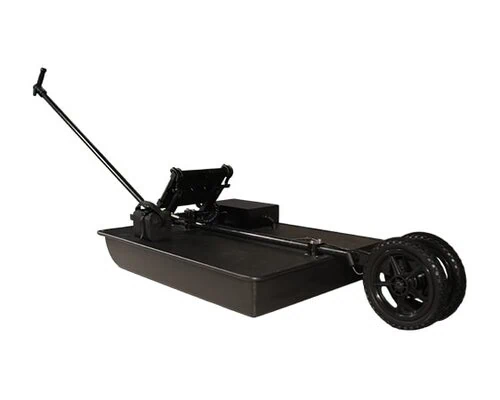
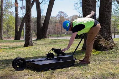
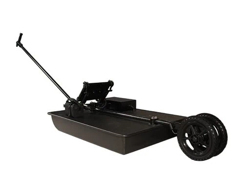
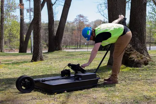
100 Series Geophysical Scanner Ground-Penetrating Radar System 100 Series Geophysical Scanner Ground-Penetrating Radar System Our Most Powerful GPR System for Geophysical Scanner Survey 100 Series geophysical scanner systems offer the greatest realistic penetration that ground-penetrating radar (GPR) can provide. It is used for locating deeper targets up to 100 ft. (30.48m). Typically, this system is most often used for locating tunnels and for geophysical analysis. Overview About the 100 Series The 100 Series is one of our most versatile systems, as the tablet and software are interchangeable with our other systems. This means that you can easily convert a 100 Series into one of our many other configurations for more high-resolution scanning applications.
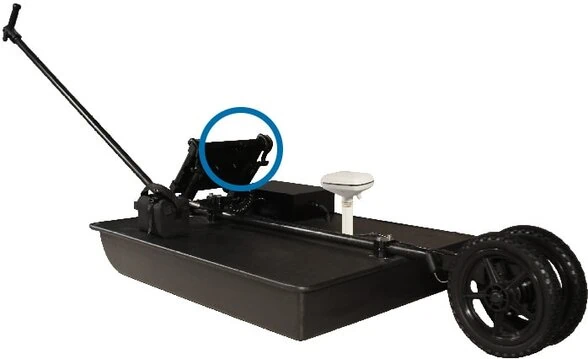
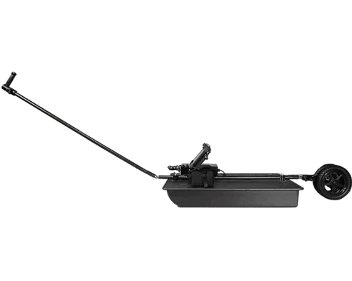
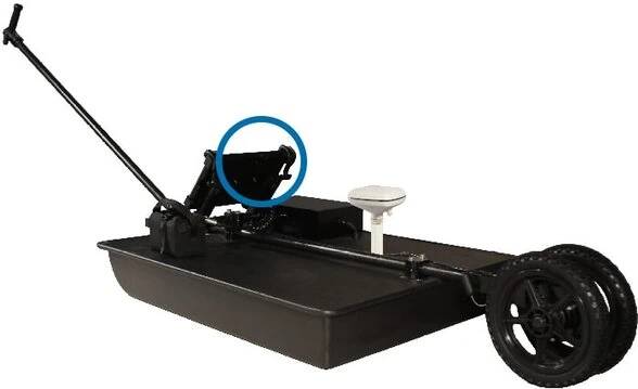
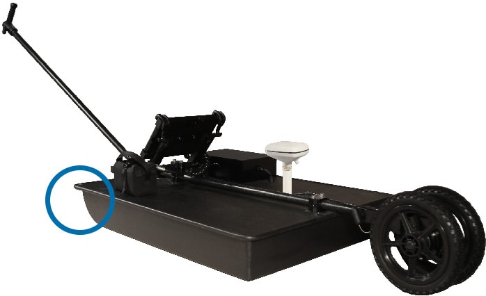
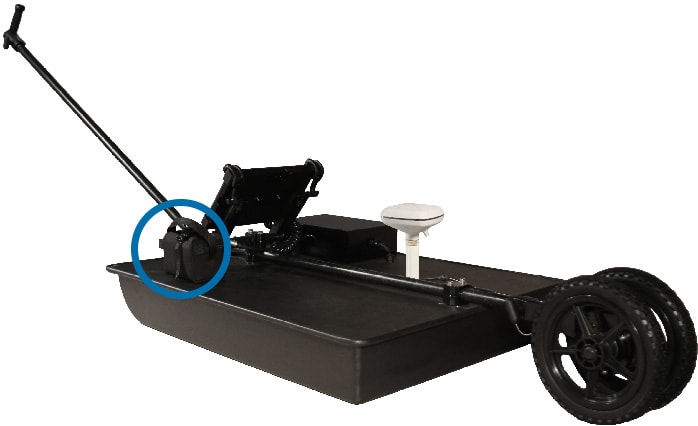
Think of your 100 Series system as more than a high-powered GPR device. When conducting a survey, you are doing more than seeing beneath the surface. You are compiling essential data that can be used to create an instant deliverable in the field – right from your tablet controller. This ensures everyone is on the same page and operating from a shared point-of-reference with greater efficiency, safety, and confidence. Featured Technologies Self-Calibrating Antenna SmartGain SmartStack StreetSmart Onboard Processing Autoconfiguration Broadband GPR Depth Calibration Applications Locating Deep/Large Utilities: Non-metallic Pipes Metallic Pipes Environmental: Tanks Rubble Limits Voids Geophysics: Strata Bedrock Strategic: Deep Tunnels Bunkers Features Durable, Glare-Resistant Tablet Interface Daylight readable, weatherproof Getac tablet interface High performance CPU enables real-time data processing Built-in 3D view capability WiFi supported USB, Ethernet, HDMI and Audio ports Sloped Antenna Easily overcomes obstacles and rough terrain Powerful low-frequency 100 MHz antenna for unmatched depth penetration Battery Packs 2 battery packs included with each system Total runtime of 10 hours Typical lifetime of several years Military Grade Connectors Never worry about loose connections Connectors hold up across a variety of weather conditions Aluminum Handle Hybrid composite/aluminum pull handle Designed to precisely avoid GPS interference Optional GPS Integration Optional GPS pole mount Enables GPS to be centered over antenna Integrates with most high-end GIS & RTK units Optional integration with Google Earth Airless, Solid Tires Can not go flat Require zero maintenance Software Our GPR Software is easy to use out of the box and perfect for on-the-go locators.
Each time you create a file, our software automatically calibrates antenna and processing settings to the materials being scanned. Mark and label points in radar data to describe what you’ve found. Measure the distance between two points to create even more context. Enhance image at a particular depth of interest using time-varying gain. Apply various filters to manually configure gain settings. Overlay radar data on satellite imaging to create reliable utility maps and see data within relevant environmental context. Add descriptions to specific coordinates to annotate radar and map data. Can be used to create as-built drawings in the field or in the office. Exports into many formats including .kmz (Google Earth), .dxf (AutoCAD), and .shp (ArcGIS).
Generate depth slice overlays, isosurface models Our data can also be processed in several third party software packages to best fit your specific needs. US Radar’s software automatically sets antenna system parameters to adjust to soil conditions. Enhance image at a particular depth of interest using time-varying gain. Apply various filters to manually configure gain settings. Choose from an array of helpful color palettes, alter gain (contrast) and zoom to view the data in different ways and gain important insights! Specifications Getac F110 TECHNICAL SPECIFICATIONS Generation G7 Operating System Windows 11 Pro Mobile Computing Platform Intel® CoreTM i5-1335U Processor Max. 4.6GHz with Intel® Turbo Boost Technology- 12 MB Intel® Smart Cache Graphics Intel® UHD Graphics Display 11.6″ Wide Viewing Angle TFT LCD FHD (1920 x 1080) Protection film 1,200 nits LumiBond display with Getac sunlight readable technology Capacitive multi-touch screen Storage & Memory 8GB DDR5 256GB PCIe NVMe SSD Keyboard Power button 4 tablet programmable buttons Pointing Device Touchscreen – Capacitive multi-touch screen Audio Integrated speaker Integrated dual-array microphone I/O Interface 5MP webcam iii 8MP auto focus rear camera x 1 Audio in/out combo x 1 DC in Jack x 1 USB 3.2 Gen 2 Type-A x 1 ThunderboltTM 4 Type-C x 1 Communication Interface Intel® Wi-Fi 6E AX211, 802.11ax Bluetooth (v5.3) iv Power AC adapter (65W, 100-240VAC, 50/60Hz) Li-ion battery (11.4V, typical 2680mAh; min.
2640mAh) x 2 Dimension (W x D x H) & Weight 314 x 207 x 25mm (12.4″ x 8.15″ x 0.98″) 1.49kg (3.29lbs) viii Rugged Feature MIL-STD-810H certified IP66 certified MIL-STD-461G certified ix Vibration & 6ft (1.8m) drop resistant x Environmental Specification Temperature xii : – Operating: -29°C to 63°C / -20°F to 145°F – Storage: -51°C to 71°C / -60°F to 160°F Humidity: – 95% RH, non-condensing Learn More About the 100 Series Today Want to learn more about how the 100 Series geophysical scanner or one of our other systems could help you on your next project? Contact us today to speak with one of our GPR experts who will be happy to help you. contact us